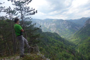
“Every mountain or mountain area is an idependent, separated little world. Till we go up on it, or climb it, we will almost walk the path from the tropics or the temperate belt to the Arctic. “
Pál Rockenbauer (1933-1987) hungarien traveller and television editor
- Idea
2.Decision
3.Ressourcen
4.Other goals
5.Route
Every single trip, hiking idea is born in the head not on the planning table. This spark is essencial to make decision. Without decision, our mission will most likely fail. After we made the decision, we should contour our goal. We need to calculate our ressources. The following questins must be answered: Can I spend hours outside in the cold weather? Am I trained for a high mountain tour? Do I have enough money to visit the desired place? What kind of vehicles can I use? What should I carry with me? Whom can I go with?
Planning a tour is like painting a picture. First you draw silhouttes then after the time moves on, a detailed picture slowly appears. In the last couple of years I only made tours for myself. In 2017 I was even a group leader for many hiking tours. Sometimes the tour was too hard for the participians. I always took this as a compliment. Time will heal up wounds so they joined me again. Weak people will fall out sooner or later.
In Hungary the landscape mostly hilly. After many years of experience I think ~30 km/day hiking tours are suitable for most (a bit trained) people. With bike the healthy distance is around 100 km/day. After I climbed the Schneeberg, I had heavy and sore muschles for 4 days. Mountain area is not a joke. On steep terrarain you can’t really go for similar distances. The muscles work much harder on uphills and downhills as well. On the other hand: I saw beautiful landscapes, I breathed fresh air, and I took awesome photos.
Usually I plan tours on internet or my smartphone. Both Osmand and Locus are life-saver apps. Recently I use the last one. Locus got a new update for this year. I really like the clear and relatively easy interface. For hungarian tours it is advisable to download the layers from turistautak.hu. With this layer you can see many hiking routes in the whole country. For Austrian tours I bought separate maps via application. You can get a whole country map or a Bundasland map, if you don’t need a larger map. Smartphone map has one big advantage: you can always see your exact location.
If I visit a foreign place, usually I plan the route 1 or 2 days before the tour. Hiking is not my major sport, therefore my strength always varies. The weather is an another important factor. The weather changes quickly in the Alps. I have a lot of plans for this year. I think the mountainbike saison will be half-legged this year (like it was in 2020), so I will concentrate on tours, not on races. I want to make a loop around lakes, try out the EuroVelo routes, visit Czech Republic, Germany and Romania, explore via ferrate routes in the area, visit bikeparks etc. Without a job I would not be bored. But I would have not money. But my weekends are free. The bigger events will be held at weekends.